Self-Guided Walking Tour of San Francisco: Build Your Own Downtown Route
How do you build a self-guided walking tour of San Francisco?
Anchor a route on the compact, mostly flat core between Union Square, Chinatown, North Beach and the Embarcadero, walk it in one direction to avoid backtracking up hills, and budget 3-5 hours including stops. Add Nob Hill or Fisherman's Wharf only if you have the legs and the time for the climbs.
Building your own route through downtown San Francisco
San Francisco’s downtown core is one of the few parts of the city where a self-guided walk genuinely works without a car, a transit pass, or much advance planning. The trick isn’t finding attractions — they’re dense and well signposted — it’s sequencing them so you’re not zig-zagging across hills or doubling back on yourself. This guide gives you a framework: how to anchor a route, how to think about the terrain, and how to adapt the plan to the time and stamina you actually have.
Unlike a fixed itinerary, a self-guided walk should flex around what you find interesting. Treat everything below as a starting skeleton, not a script.
Why downtown San Francisco works for a self-guided walk
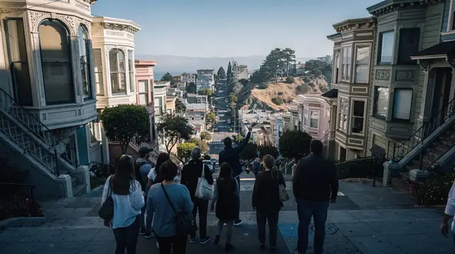
Most of San Francisco is genuinely hilly, but the downtown core — Union Square, the Financial District, Chinatown, and the flat stretch of the Embarcadero — sits on some of the gentlest terrain in the city. That makes it possible to string together four or five distinct neighborhoods in a single loop without the leg-burning climbs that define hillier routes toward Russian Hill or Twin Peaks.
The second reason downtown works well: it’s compact. Union Square to the edge of North Beach is about a 20-minute walk at a normal pace, and the whole core fits inside roughly a 2 km by 1.5 km rectangle. You can cover a lot on foot in a morning or afternoon without ever needing a bus.
The anchor: pick one starting point and build outward
Start with a single anchor point rather than trying to plan stop-by-stop from the beginning. Union Square is the most practical choice for most visitors: it’s served directly by Muni and BART, sits within walking distance of the Financial District, Chinatown and Union Square shopping, and gives you a natural jumping-off point in more than one direction.
From that anchor, a workable core loop looks like this:
- Union Square — start here, get oriented, note the cable car turnaround nearby if you plan to ride one later.
- Chinatown — walk north up Grant Avenue or Stockton Street; Chinatown’s main gate is a 5-10 minute walk from Union Square.
- North Beach — continue north out of Chinatown; this is San Francisco’s historically Italian district, flatter than its hillside reputation suggests along the main commercial streets.
- The Embarcadero — walk east and downhill toward the waterfront, finishing at the Ferry Building.
This sequence moves roughly north then east, which means you’re not backtracking through the same blocks twice — a small thing that saves real time and energy over a multi-hour walk.
How much time to budget
| Route scope | Distance (approx.) | Time with stops |
|---|---|---|
| Union Square only | under 1 km | 30-45 minutes |
| Union Square → Chinatown | 1-1.5 km | 1-1.5 hours |
| Union Square → Chinatown → North Beach | 2.5-3 km | 2.5-3.5 hours |
| Full core loop to the Embarcadero | 4-5 km | 3.5-5 hours |
| Full loop + Nob Hill detour | 6-7 km | 5-6.5 hours |
These ranges assume a relaxed pace with stops for food, photos and browsing — not a fitness walk. Add 30-45 minutes if you’re visiting in the city’s foggy summer months (June-August), when a slower pace and extra coffee stops are common simply to stay warm; a layered jacket is worth carrying even on a summer walk.
Working the terrain: what to route around, not through
The one honest caveat to “downtown is flat” is Nob Hill, which sits directly between Union Square and Russian Hill and is genuinely steep — its cable car lines exist specifically because 19th-century San Francisco needed a mechanical answer to those grades. If your route skeleton includes Nob Hill, treat it as a deliberate detour with its own time budget, not something you route through casually on the way to somewhere else.
A practical way to handle this: build your core loop on the flatter blocks (Union Square, Chinatown, North Beach, Embarcadero), then decide separately whether you have the time and legs for a Nob Hill add-on. If you do want the hill without the full climb, the California Street cable car line runs along one of Nob Hill’s ridgelines and can substitute for part of the walk.
Extending the loop: Fisherman’s Wharf and the waterfront
From the Embarcadero, Fisherman’s Wharf and Pier 39 are a further 20-25 minute walk north along the waterfront, largely flat. This extension roughly doubles your total walking time but adds a genuinely different atmosphere — working piers, sea lions, and the departure point for Alcatraz ferries at Pier 33.
If you’re building a full-day version of this walk, a sensible order is: Union Square → Chinatown → North Beach → Fisherman’s Wharf → Embarcadero → Ferry Building, finishing near transit connections back to your accommodation rather than stranding yourself back at the starting point.
A food-focused variant of the same route
If eating along the way matters more to you than covering ground, the same downtown skeleton works as a food walk rather than a sightseeing loop. Chinatown and North Beach both have enough density of small, walkable food stops that a guided version can go deeper than a self-planned route usually does — the Chinatown food tour guide and the North Beach food tour guide both lay out stop-by-stop options if you’d rather follow a curated food route through the same two neighborhoods than research it yourself.
Stop-by-stop logic: what to look for at each anchor
Union Square: this is a shopping and transit hub more than a scenic stop — use it as your starting and orientation point, and note the Powell Street cable car turnaround a block away if you’re planning to ride later in the day.
Chinatown: enter through the ornate gate on Grant Avenue at Bush Street. The two parallel streets — Grant Avenue (tourist-facing, ornamental) and Stockton Street (the neighborhood’s actual daily market) — tell very different stories about the same few blocks; walking both, even briefly, gives a fuller picture than either alone.
North Beach: this is where a self-guided walk rewards slowing down. Washington Square Park, the surrounding cafes, and the walk up toward Coit Tower (itself a steeper detour worth weighing against your time budget) all sit within a few blocks of each other.
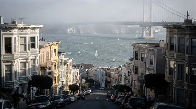
The Embarcadero: the Ferry Building at the eastern end is a natural finish line — food stalls, ferry connections to Sausalito and Oakland, and views back across the bay toward the Bay Bridge.
When a self-guided walk isn’t the right fit
A self-guided route works best when you want control over pace and no fixed schedule. It works less well if you want historical context and storytelling woven into the walk itself — dates, anecdotes, and the “why” behind a building or a street name are exactly what a route map can’t give you. If that context matters more than flexibility, a guided downtown walking tour covers similar ground with a local narrator filling in the gaps a self-guided plan leaves blank.
For a more personal, conversational version of the same idea, a walking tour led by a local resident tends to wander more responsively — useful if you’d rather ask questions as you go than follow a fixed loop.
Combining walking with a cable car
If your legs are tired by the time you reach North Beach or you want to experience the cable car system without treating it as your only mode of transport, boarding partway along a route — rather than queueing at the Powell Street terminus, where waits commonly run 30-60+ minutes — fits naturally into a self-guided plan. A single one-way ride costs a flat $8 per person with no transfers, payable via kiosk, the MuniMobile app, or a Clipper card.
For visitors who’d rather have the cable car ride built into a structured walk instead of handling logistics themselves, a walking tour that includes a cable car ride bundles both into one outing, and a self-guided cable car app tour offers a middle ground — an app-narrated route you still walk and ride at your own pace.
Adapting the framework beyond downtown
The same logic — pick a flat anchor, build outward in one direction, treat hills as deliberate detours — applies to other parts of the city, though downtown remains the easiest place to start because of its terrain and transit access. North Beach and the Embarcadero each support their own shorter self-guided loops if you’d rather split the walk across two visits instead of one long day.
If you want a second self-guided route once you’ve done the downtown core, Golden Gate Park offers a completely different kind of walk — green space rather than street grid — and the Haight-Ashbury district connects to it on foot for visitors who want to extend a walking day rather than start a new one.
Two other neighborhoods reward the same “pick one anchor, walk outward” approach if you have a second or third day in the city. The Haight-Ashbury neighborhood guide covers a walkable district adjoining Golden Gate Park with its own distinct character, and the Mission District neighborhood guide works as a separate self-guided loop entirely — flatter than downtown in most places, and built around murals and food rather than historic commercial streets. For Golden Gate Park itself, the Golden Gate Park walking tour guide applies the same stop-by-stop logic used here to a green-space route instead of a street grid.
Getting downtown and getting around
Most visitors reach the starting point of this route by transit rather than car — Union Square is a Muni and BART stop, which avoids the parking and one-way-street complications of driving downtown. If you’re arriving from outside the city or unsure which system to use for the rest of your trip, the getting around San Francisco guide and the BART vs. Muni guide both cover the practical differences, and the do you need a car in San Francisco piece is worth reading before you decide whether to rent one for a trip built mostly around walking.
Practical notes before you go
- Footwear matters more than distance. San Francisco’s sidewalks are solid, but even the “flat” downtown core has enough gentle grade and cross-streets that comfortable shoes outperform a packed daily step count.
- Carry a jacket regardless of season. The marine layer known locally as Karl the Fog affects downtown less than the coast, but wind off the bay near the Embarcadero can still cut through a t-shirt on an otherwise mild day.
- Watch for one-way streets and cable car tracks when crossing — downtown’s grid includes active cable car lines on California, Powell, Hyde and Mason streets, and the cars have the right of way.
- Don’t leave anything visible in a parked car if you drove downtown; theft from parked vehicles has declined sharply since 2017 but remains a real risk, and it’s unrelated to whether you’re walking or driving for the rest of your day.
- Sales tax and tipping apply to anything you buy along the way — expect roughly 8.6% added at the till in San Francisco, and a tip of 18-20%+ if you sit down anywhere rather than grabbing food to go. The tipping in San Francisco guide covers the finer points if you want more than a rule of thumb.
- Check the season before you pack. Fog patterns and temperature swing enough month to month that the San Francisco weather by month guide and the San Francisco packing list are worth a look before a walk-heavy trip, whatever time of year you’re visiting.
Fitting this walk into a longer San Francisco trip
A self-guided downtown walk works as a standalone half-day or as the anchor of a longer stay. If this is your first visit and you’re still building the rest of your itinerary, the first-time visitor San Francisco itinerary and the how many days do you need in San Francisco guide both help place this walk within a wider plan. For a trip built entirely around walking and transit rather than a rental car, the car-free San Francisco itinerary and the three days in San Francisco itinerary both slot a version of this downtown route into a multi-day schedule alongside neighborhoods like the Mission and Golden Gate Park.
Self-guided San Francisco walking tour: frequently asked questions
How long does a self-guided walking tour of downtown San Francisco take?
Plan on 3-5 hours for the core route from Union Square through Chinatown, North Beach and the Embarcadero, including stops for photos, food and browsing. Add another 1.5-2 hours if you extend up Nob Hill or out to Fisherman’s Wharf.
Is downtown San Francisco flat enough to walk?
The core between Union Square, Chinatown and the Embarcadero is largely flat or gently sloped. The steep sections are concentrated on Nob Hill and Russian Hill, which you can route around or treat as an optional detour rather than the spine of your walk.
Do I need to book anything for a self-guided walk?
No tickets are required to walk the streets themselves. If your route includes a cable car ride, buy that separately ($8 per person, one-way, no transfers) at a kiosk, via the MuniMobile app, or with a Clipper card.
What’s the best starting point for a self-guided San Francisco walk?
Union Square works well because it’s central, served by Muni and BART, and puts Chinatown, the Financial District and North Beach all within a 10-15 minute walk, letting you build a loop rather than an out-and-back.
Can I combine a self-guided walk with a cable car ride?
Yes — many self-guided routes end or begin at a cable car turnaround. Boarding partway along the route, rather than queueing at the Powell Street terminus, is usually faster and fits naturally into a walking itinerary.
Is it better to walk downtown San Francisco alone or with a guide?
A self-guided walk gives you full control over pace and stops and costs nothing beyond your own time. A guided walking tour adds local commentary and historical context you won’t get from a map alone — worth it if storytelling matters as much as the route itself.
How do I avoid the worst hills on a downtown walking route?
Stay on the grid below California Street and Powell Street’s upper blocks. Union Square, Chinatown’s main corridors, North Beach and the Embarcadero waterfront are all manageable; Nob Hill and Russian Hill are the sections to treat as optional add-ons, not the main path.
Walking Tours of San Francisco
Verified deep-linked GetYourGuide tours. Book through these links and we earn a small commission at no cost to you.
GetYourGuide does not provide a product photo for this activity — the image shows the meeting point, photographed by us.