Most visitors arrive expecting one city and discover a base for an entire region. San Francisco itself is compact enough to walk across in an afternoon, but the trip that people actually take — the Golden Gate Bridge, Alcatraz, Muir Woods, Sausalito, Oakland — spills well beyond the peninsula tip the city sits on. This guide focuses on the part that ties everything together: how the neighborhoods relate to one another, and how to move between them without a rental car.
The shape of the city
San Francisco occupies the northern tip of a hilly peninsula, bounded by the Pacific Ocean to the west, San Francisco Bay to the east and north, and connected south to the rest of the Peninsula and Silicon Valley. That geography explains almost everything about how a visit feels: the whole built-up city is only about 7 by 7 miles, so a first-time visitor is rarely more than a 20-30 minute transit ride from any other part of it.
Think of the city in loose clusters rather than a grid to memorize:
- Downtown core — Union Square, the Financial District, and SoMa (home to the Museum of Modern Art and Oracle Park) sit on the flatter eastern side, closest to the Bay Bridge and BART.
- Northeast waterfront — Chinatown, North Beach, Nob Hill, Russian Hill, the Embarcadero, and Fisherman’s Wharf/Pier 39 wrap around the northeastern shoreline, with Alcatraz ferries departing from Pier 33.
- The Golden Gate side — the Marina district and the Presidio lead out to the Golden Gate Bridge itself, on the city’s northwest corner.
- The green middle — Golden Gate Park and the Haight-Ashbury cut across the city’s midsection.
- The southern neighborhoods — the Mission District, the Castro, and Twin Peaks sit further south and inland, generally sunnier than the coast.
- The foggy west — Ocean Beach and the Sunset and Richmond districts line the Pacific edge, and are reliably cooler and greyer than neighborhoods just a few kilometres inland.
That last point matters more than most guides admit. San Francisco has a well-documented microclimate split: the Mission and Noe Valley, sheltered by hills, routinely run several degrees warmer and sunnier than Ocean Beach or the Sunset on the very same afternoon. If a morning at the coast feels disappointingly grey, a short ride inland can mean genuinely different weather, not just a different view.
Getting around without a car
The single most common mistake first-time visitors make is renting a car to explore the city itself. Streets are steep, many are one-way, parking downtown commonly runs $3-8 an hour with daily maximums of $30-60 in high-demand areas like Union Square, and a parked car is the most common target for opportunistic break-ins. None of that trouble buys you anything a transit pass doesn’t already cover inside city limits — a rental car earns its keep on day trips out of town, not on getting from Chinatown to the Mission.
Muni is SFMTA’s bus, streetcar and cable car network, and it’s the workhorse for getting across San Francisco. A single adult ride with a Clipper card is $2.85, valid for 120 minutes including transfers — so a morning that touches three neighborhoods can run on one fare. Muni routes cover ground the cable cars and BART simply don’t reach, including most of the Mission, the Castro, the Sunset, and the Richmond.
BART is a regional heavy-rail system, and inside the city it makes far fewer stops than Muni — its real strength is longer hops: a direct line from SFO airport to downtown (about $11.15 one-way on Clipper), and connections east to Oakland and Berkeley. Don’t reach for BART to cover the two or three stops between adjacent neighborhoods; that’s Muni’s job.
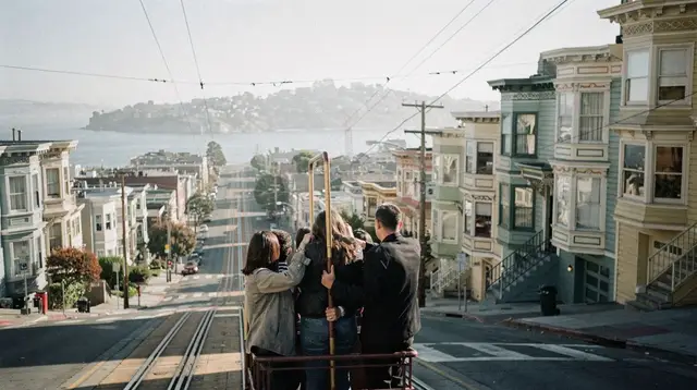
Cable cars are worth riding once, not relying on daily. A single ride on any of the three lines (Powell-Hyde, Powell-Mason, California Street) costs a flat $8 with no transfers. The Powell Street turnaround near Union Square is the busiest boarding point in the whole system, with queues that commonly run 30-60+ minutes at peak times; boarding partway along the route, or choosing the less-touristed California Street line, is usually faster than waiting at the terminus. This is a slow, historic, grip-operated system and a genuine National Historic Landmark — treat it as an experience, not transport, and a Muni bus will get you across town faster on an ordinary day. Several operators run a self-paced, app-guided cable car route that turns the ride itself into a short walking-and-riding tour of the northeast waterfront.
Ferries depart the Ferry Building and Pier 41 area for Sausalito, Tiburon, Angel Island, and Oakland/Alameda, and are often a faster, traffic-free, and more scenic way to reach Marin than crossing the Golden Gate Bridge by car.
Clipper card is the region’s all-in-one transit card — it works across Muni, BART, Caltrain, and the ferries, and is also available as a phone pass via Apple Pay or Google Pay. Tap in everywhere, and tap out too on BART.
A first-time visitor’s day-by-day logic
Rather than criss-crossing the city, group your days by cluster and let the neighborhoods that sit near each other share a day:
| Day focus | Neighborhoods | How to move between them |
|---|---|---|
| Downtown & Chinatown | Union Square, Financial District, Chinatown, North Beach | Walking + one cable car ride |
| Waterfront & Alcatraz | Embarcadero, Fisherman’s Wharf, Pier 39, Alcatraz | Walking + Muni + Alcatraz ferry from Pier 33 |
| Golden Gate & the Presidio | Marina, Presidio, Golden Gate Bridge | Muni bus or a rented bike |
| Parks & the Haight | Golden Gate Park, Haight-Ashbury | Muni |
| Mission & Castro | Mission District, Castro, Twin Peaks | Muni + walking |
For an overview pass with flexible re-entry to Alcatraz, the aquarium-style waterfront attractions, and city tours, a bundled option like the San Francisco Explorer Pass or the 9 Day CityPASS can simplify ticketing across several attractions rather than buying each one separately. Travelers planning a tighter, attraction-dense schedule sometimes compare that against an hourly pass such as the 72 Hour Go San Francisco Card, which prices by time rather than by attraction count.
Once you’ve covered the city itself
San Francisco’s peninsula position means almost everything else in this guide’s scope is a short hop away, not a separate trip. The Golden Gate Bridge and Muir Woods sit 20-45 minutes north across the bridge; Sausalito is reachable by the same drive or by a traffic-free ferry from the Embarcadero; Oakland is 20-40 minutes east via BART or the Bay Bridge. Further out, Napa Valley and Sonoma each run about 1-1.5 hours by car with no direct train, and the coastal run down to Monterey, Carmel-by-the-Sea, and eventually Big Sur stretches from about 2 to 3 hours one-way.
For a self-guided sense of scale and a look at how far each of those areas actually sits from downtown, the San Francisco neighborhoods guide breaks down the districts individually, and Getting Around San Francisco goes deeper on transit passes and routing. If you’re deciding how long to budget for the city before venturing further, How Many Days Do You Need in San Francisco walks through realistic pacing, and Do You Need a Car in San Francisco covers the rental-car question in more depth than this page can.
Travelers weighing a single tight day versus a longer stay can compare the San Francisco in One Day and San Francisco Two-Day Highlights itineraries, while those without a car at all should look at the Car-Free San Francisco Itinerary, built entirely around Muni, BART, and ferries.
For visitors who want a single bay-wide overview by water rather than by land, a short outing like the San Francisco Bay 1 Hour Cruise passes the Golden Gate Bridge, Alcatraz, and the waterfront in one sitting — useful for orientation on your first afternoon before committing to which neighborhoods to prioritize on foot.
A note on weather and timing
San Francisco’s summer (June-August) is its coolest, foggiest season in the city itself — “Karl the Fog” rolls in over the Golden Gate regularly and can linger through the day, with highs often sitting in the 15-19°C (60-66°F) range near the coast. September and October are the city’s real summer: the fog retreats, afternoons run warm and clear, and this is the best-documented window for unobstructed Golden Gate Bridge views. Pack a layered jacket regardless of when you visit; it’s useful every month of the year.
Practical basics for the city stay
Sales tax (about 8.625% combined) is added at checkout, never shown on menus or price tags, and tipping is expected on top — commonly 18-20%+ at sit-down restaurants, a dollar or two per drink at a bar, and roughly 15-20% for taxis and rideshare. San Francisco runs on Pacific Time (UTC-8 in winter, UTC-7 during daylight saving), and most Western European, UK and many other visitors travel under the Visa Waiver Program with an ESTA rather than a full visa — apply online well before departure.
San Francisco visitor FAQ
Do I need a car in San Francisco itself?
No. Parking is expensive and scarce, many streets are steep and one-way, and Muni, BART, cable cars, ferries and walking cover the city more reliably than driving. A car becomes useful once you head out to Wine Country, the Peninsula, or down Highway 1.
How do the neighborhoods relate to each other geographically?
San Francisco sits on a compact peninsula tip, so most central neighborhoods are within a few kilometres of each other. Downtown (Union Square, the Financial District, SoMa) anchors the east side; North Beach, Chinatown, Nob Hill and Russian Hill sit just northwest; the Marina and Presidio lead toward the Golden Gate Bridge; Golden Gate Park, the Haight, the Mission and the Castro spread across the southern half; and Ocean Beach with the Sunset and Richmond districts form the fog-prone western edge.
What’s the difference between Muni and BART?
Muni is SFMTA’s citywide network of buses, streetcars, and cable cars, best for trips within San Francisco (a single ride is $2.85, valid 120 minutes including transfers). BART is a regional rail system connecting San Francisco to the East Bay, the Peninsula, and SFO airport — it makes far fewer stops inside the city itself, so it’s the better choice for longer hops, not for getting from one nearby neighborhood to another.
Are cable cars a practical way to get around?
Not really — they’re a slow, historic experience worth riding once, not daily transport. A single ride costs a flat $8 with no transfers, and the Powell Street turnaround routinely has 30-60+ minute queues. A Muni bus or streetcar covers the same ground faster on a normal day.
How many days should I plan for San Francisco before day trips?
Three to four nights lets you cover the core neighborhoods, Alcatraz, and the waterfront without rushing. Add extra nights for any day trips into Marin, Wine Country, or down the coast, since those are best treated as separate outings rather than squeezed into a city-only itinerary.
Which neighborhoods are walkable to each other?
Union Square, the Financial District, Chinatown, North Beach and Nob Hill form a walkable downtown cluster. Fisherman’s Wharf and the Embarcadero connect along the waterfront. The Mission, Castro and Haight-Ashbury are each walkable internally but sit far enough apart that Muni or a short ride is more realistic between them.
Is San Francisco safe for tourists in 2026?
Most visitor areas are safe to walk, but the city’s best-documented visitor-facing risk is car break-ins, not street crime. Reported incidents have fallen sharply from their 2017 peak, but the standing advice hasn’t changed: never leave anything visible in a parked car.
What should I pack, even in summer?
A layered jacket, year-round. Summer is San Francisco’s foggiest, coolest season in the city itself, with daytime highs often in the 15-19°C (60-66°F) range near the coast — the opposite of what most visitors expect from a California trip in July.