San Francisco Neighborhoods: A Visitor's Guide to Where to Spend Your Time
What are San Francisco's main neighborhoods for visitors?
Union Square and the Financial District form the commercial core, Fisherman's Wharf and North Beach anchor the touristy waterfront, Chinatown and Nob Hill sit between them, and the Mission, Castro and Haight-Ashbury hold the city's neighborhood character further south and west. Each has a distinct feel, and few visitors need to see all of them on a short trip.
San Francisco is a city of small, distinct neighborhoods
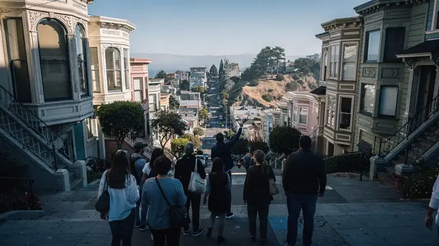
San Francisco packs an unusual number of distinct neighborhoods into a compact, 7-mile-by-7-mile grid, and that compactness is exactly why a visitor benefits from knowing them apart before arriving. Walk three or four blocks in almost any direction here and the character of the street can change completely — from souvenir shops to dim sum counters, from glass office towers to Victorian houses, from fog-cooled sidewalks to a sunny, sheltered courtyard. Deciding where to spend time, and where to base yourself, matters more in San Francisco than in many larger, more homogeneous cities.
This guide surveys the neighborhoods a typical visitor actually encounters, what each one is genuinely good for, and how they connect to each other. For a broader look at the whole city and its microclimates, see the San Francisco neighborhoods overview that anchors this section, and for getting between them, the guide to getting around San Francisco.
Union Square and the Financial District: the practical center
Union Square is San Francisco’s commercial and shopping hub — department stores, hotels, theaters, and the base of the Powell Street cable car turnaround, where queues for the Powell-Hyde and Powell-Mason lines commonly run 30 to 60 minutes or more at peak times. It’s the single most convenient neighborhood to stay in for a first visit: central to Muni and BART, walkable to Chinatown and Nob Hill, and a reasonable taxi or rideshare ride from most other neighborhoods.
The Financial District, just east and north, is San Francisco’s downtown skyline — office towers, the Transamerica Pyramid area, and, further toward the water, the Embarcadero and Ferry Building, where ferries depart for Sausalito, Tiburon, and Oakland. It empties out on evenings and weekends, so it’s a neighborhood for daytime business and transit more than evening atmosphere. A self-guided walking tour of San Francisco commonly starts here, or you can join a guided option:
a guided walking tour through the downtown core, which threads Union Square, the Financial District and the edge of Chinatown with a local guide filling in context you’d otherwise miss.
Chinatown: dense, historic, and easy to underestimate
San Francisco’s Chinatown, reached on foot from Union Square in a few minutes, is one of the oldest and largest Chinatowns outside Asia — narrow, crowded streets, produce markets, tea shops, temples tucked into upper floors, and a genuinely different pace from the blocks around it. It rewards slow walking rather than a quick pass-through, and it’s easy to misjudge as purely a tourist strip when much of it still functions as a real, lived-in neighborhood. The Chinatown neighborhood guide and a set of Chinatown etiquette tips are worth reading before a visit, and a food-focused pass is covered separately in the Chinatown food tour guide.
A guided option removes the guesswork of which alleys and shops are worth a stop:
a walking tour through Chinatown with a local guide, which typically covers the market streets, a temple stop, and a few food tastings along the way.
Nob Hill and Russian Hill: quiet, steep, and residential
Uphill from Union Square, Nob Hill is one of San Francisco’s most storied residential neighborhoods — grand hotels, Grace Cathedral, and views across downtown from streets steep enough that the cable cars were built specifically to climb them. It’s quieter than Union Square at street level and makes a comfortable, slightly upscale base if you don’t mind the hills.
Russian Hill, just northwest, adds Lombard Street’s famous switchback block — one of the most-photographed short stretches of road in the city, usually crowded with visitors on foot and in cars during the day. Both neighborhoods are best experienced on foot or by cable car rather than by driving; parking is scarce and the grades are steep enough that cars must have their wheels turned to the curb when parked facing up or downhill, a rule the city actively enforces.
Fisherman’s Wharf and Pier 39: the waterfront tourist hub
Fisherman’s Wharf is San Francisco’s most visited — and most openly commercial — waterfront stretch: seafood restaurants, souvenir shops, the sea lions hauled out on the docks at Pier 39, and the departure point for Alcatraz ferries at Pier 33, a few blocks east. It leans heavily into being a tourist destination, and most visitors are well served by budgeting a couple of hours rather than a full day here. The Fisherman’s Wharf neighborhood guide and a rundown of Fisherman’s Wharf tourist-trap myths both help set expectations before you go, and the area’s evening options are covered in the Fisherman’s Wharf evening entertainment guide.
Adjacent North Beach, San Francisco’s historic Italian neighborhood, is a better bet for an actual sit-down meal — cafés, bakeries, and the City Lights bookstore associated with the Beat generation. The North Beach walking tour guide covers both the food and the literary history in more depth.
SoMa: museums, the ballpark, and the convention core
South of Market — SoMa — is San Francisco’s museum and convention district: the San Francisco Museum of Modern Art, Oracle Park (home of the Giants), Moscone Center, and a growing residential and tech-office mix. It’s less scenic than the hill neighborhoods but functionally important if a trip includes a game, a convention, or a museum stop, and it connects easily to the rest of downtown on foot or by Muni.
The Mission District: food, murals, and warmer weather
The Mission District, southeast of downtown, is where much of San Francisco’s food culture concentrates — taquerias, bakeries, bars, and a dense mural scene along Balmy Alley and Clarion Alley that documents decades of Latino heritage and neighborhood history. It also benefits from San Francisco’s microclimate split: sheltered by hills to the west, the Mission is routinely several degrees warmer and sunnier than the fog belt out toward Ocean Beach on the very same day, which makes it a reliable choice on a grey, foggy afternoon elsewhere in the city.
The Mission District neighborhood guide and a roundup of the best Mission burritos are the practical companions to a visit here. Like any dense urban neighborhood, ordinary city-visitor caution applies after dark — stick to busy, well-lit streets and don’t leave anything visible in a parked car.
The Castro: San Francisco’s LGBTQ+ neighborhood
The Castro, just west of the Mission, is San Francisco’s historic LGBTQ+ neighborhood — rainbow crosswalks at 18th and Castro streets, the landmark Castro Theatre, and a concentration of bars, shops and community history dating back to the gay rights movement of the 1970s. It’s smaller and more compact than the Mission, easily combined with it on the same afternoon, and its history is covered in more depth in the Castro neighborhood history piece.
Haight-Ashbury and Golden Gate Park: counterculture history and green space
Haight-Ashbury, the epicenter of the 1967 Summer of Love, still trades on that history — vintage clothing shops, record stores, and murals referencing the counterculture era — though the neighborhood today is a fairly conventional commercial strip rather than a living hippie enclave. Its real draw for most visitors is the adjacent entry to Golden Gate Park, San Francisco’s largest green space, home to gardens, museums and miles of paths. The Haight-Ashbury neighborhood guide and Golden Gate Park walking tour guide cover both halves of a combined visit, and an easy way to cover the ground is on two wheels:
a guided e-bike tour tracing Summer of Love sites and Golden Gate Park, which covers more distance in an afternoon than most visitors would manage on foot.
Twin Peaks, the Sunset, the Richmond, and Ocean Beach
Twin Peaks, near the geographic center of the city, offers one of San Francisco’s best panoramic viewpoints — on a clear day, a sweep from downtown to the bay and out toward the ocean, though fog frequently obscures part or all of the view, especially in summer. West of Twin Peaks, the Sunset and Richmond districts are quieter, largely residential grids running out to Ocean Beach, the city’s long Pacific-facing shoreline. These western neighborhoods sit squarely in San Francisco’s fog belt: colder and windier than the Mission or downtown on the same day, and worth a jacket even in July or August. The Ocean Beach what-to-know piece covers what the beach is (and isn’t) good for — it’s not a swimming beach, given cold water and strong currents.
How the neighborhoods connect
| Neighborhood | Known for | Best reached by |
|---|---|---|
| Union Square / Financial District | Shopping, cable car turnaround, transit hub | Muni, BART, walking |
| Chinatown | Markets, temples, dense historic streets | Walking from Union Square |
| Nob Hill / Russian Hill | Grand hotels, views, Lombard Street | Cable car, walking |
| Fisherman’s Wharf / North Beach | Pier 39, Alcatraz ferry, Italian food | Cable car, Muni, walking |
| SoMa | Museums, Oracle Park, conventions | Muni, walking |
| Mission District | Food, murals, warmer microclimate | Muni, BART (16th/24th St) |
| Castro | LGBTQ+ history, nightlife | Muni Metro (Castro station) |
| Haight-Ashbury | Counterculture history, Golden Gate Park entry | Muni bus |
| Sunset / Richmond / Ocean Beach | Quiet residential, Pacific coastline, fog | Muni bus, Muni Metro |
A single day rarely covers more than two or three of these areas comfortably, given San Francisco’s hills and the time it takes to walk them properly. Visitors building a first itinerary often find it easier to group neighborhoods geographically — downtown, Chinatown and Nob Hill on one day; the Mission, Castro and Haight on another — rather than crisscrossing the city. The first-time visitor itinerary and the car-free San Francisco itinerary both structure a trip this way, and a broader city tour is another option if time is tight:
a guided highlights tour covering several neighborhoods in one outing, useful for visitors with only a day or two who want an overview before deciding where to return on foot.
Practical notes for choosing a base
Most visitors do best basing themselves in or near Union Square, the Financial District, or Nob Hill — central, well served by transit, and close to the cable car lines, even accepting the queues at the Powell Street turnaround. The things to do in San Francisco hub and the Chinatown activities page both group bookable experiences by area if you’re planning around a specific neighborhood rather than the city as a whole.
A car is a liability inside these neighborhoods — parking is scarce and expensive, many streets are steep and one-way, and a parked car is a target for break-ins if anything is left visible inside, even with San Francisco’s break-in rate down sharply from its 2017 peak. Muni, BART, the cable cars, the ferries, and walking cover the neighborhoods above more efficiently than driving between them ever would; save the rental car for day trips out of the city.
Frequently asked questions about San Francisco’s neighborhoods
Which San Francisco neighborhood should first-time visitors stay in?
Union Square or the Financial District is the most practical base: walkable to cable cars, close to Muni and BART, and central to day trips. Nob Hill offers a quieter, slightly more upscale alternative a short walk uphill from the same hub.
Is Fisherman’s Wharf worth visiting, or is it just a tourist trap?
It’s genuinely touristy — chain restaurants, souvenir shops, crowds — but Pier 39’s sea lions, the ferry to Alcatraz from Pier 33, and views across the bay are real draws. Most visitors budget a couple of hours there rather than a full day.
Is the Mission District safe and worth a visit?
The Mission is a mainstream, well-visited neighborhood known for its food scene, murals and warmer microclimate. Like most dense urban areas, stick to well-lit, busy streets at night and don’t leave anything visible in a parked car.
What’s the difference between the Castro and the Mission District?
The Castro is San Francisco’s historic LGBTQ+ neighborhood, smaller and centered on a few blocks near Castro Street, with rainbow crosswalks and a landmark movie theater. The Mission is larger, known for Latino heritage, murals, taquerias and a lively bar scene, and sits just east of the Castro.
Is Haight-Ashbury still worth seeing today?
Yes for the history and the access to Golden Gate Park, though the 1967 Summer of Love counterculture scene is mostly commemorated rather than still present — expect vintage shops and murals more than a living hippie enclave.
Which neighborhood has the best weather in San Francisco?
The Mission and Noe Valley, sheltered by hills, are routinely several degrees warmer and sunnier than fog-prone areas like Ocean Beach or the Sunset and Richmond districts on the same day — San Francisco’s microclimates can differ noticeably within a few kilometres.
How do you get between San Francisco’s neighborhoods without a car?
Muni buses and streetcars, BART for a handful of central stops, and walking cover most neighborhoods well; cable cars connect Union Square to Fisherman’s Wharf and Nob Hill but are slow and better treated as an experience than daily transport.
San Francisco by Neighborhood
Verified deep-linked GetYourGuide tours. Book through these links and we earn a small commission at no cost to you.
GetYourGuide does not provide a product photo for this activity — the image shows the meeting point, photographed by us.