San Francisco Chinatown: A Neighborhood Guide to Layout, Gate and History
What makes San Francisco's Chinatown different from other Chinatowns?
It's the oldest Chinatown in North America and the largest outside Asia, built on steep hills rather than flat blocks, entered through a ceremonial Dragon Gate on Grant Avenue, and split between a tourist-facing main strip and a much more local, working alleyway network one block over on Stockton Street.
Most visitors arrive at San Francisco’s Chinatown expecting a slightly bigger, slightly older version of a Chinatown they’ve already seen somewhere else — a strip of restaurants and souvenir shops with some pagoda roofs bolted on. What’s actually there is stranger and better than that: the oldest Chinatown in North America, built not on a flat grid but straight up a hillside between Union Square and Nob Hill, entered through a formal ceremonial gate, and split into two parallel neighborhoods — one built for visitors, one built for the people who live and shop there — running block for block, one street apart.
The Dragon Gate: where Chinatown officially starts
Chinatown’s most photographed feature is also its clearest orientation point: the Dragon Gate (sometimes called the Chinatown Gate), spanning Grant Avenue at Bush Street. Built in 1970 as a gift from the Republic of China (Taiwan), it’s a traditional paifang — a ceremonial archway topped with two dragons flanking a pearl, guarded at its base by a pair of stone lions, and inscribed with a phrase from Sun Yat-sen usually translated as “all under heaven is for the good of the people.”
The gate isn’t a wall and it isn’t a border checkpoint — Chinatown has no fence, and its blocks blend into the Financial District and Nob Hill without any hard edge. But it functions as the neighborhood’s front door in practice: it’s roughly a 5-10 minute walk north from Union Square, it’s where most self-guided routes and guided walks begin, and it’s the spot nearly every visitor photographs on the way in. Passing under it and continuing north on Grant Avenue is the single most common way to start a Chinatown visit, and it’s worth pausing here for a minute before diving in, since almost everything else in the neighborhood is graded relative to this point.
Two Chinatowns, one block apart
The single most useful thing to understand about the neighborhood’s layout is that there are effectively two Chinatowns running in parallel, a block apart, and most visitors only ever see one of them.
Grant Avenue is the historic tourist spine — the street with the pagoda-topped facades, the strings of paper lanterns, the souvenir shops selling silk, jade and tourist trinkets, and the postcard version of Chinatown that appears in most photographs. It’s real, it’s historic (it follows San Francisco’s original 1830s street grid), and it’s worth walking. But it is built, and has been for well over a century, to be looked at by outsiders.
Stockton Street, one block to the west, is where Chinatown actually shops. This is the produce market street — crates of bok choy and dragon fruit spilling onto the sidewalk, herbalists, fish markets, bakeries selling barbecue pork buns to a lunchtime queue of locals rather than tourists, and far less English signage. It’s louder, more crowded, and has essentially no souvenir shops. Many visitors never cross over to it, which means they see the neighborhood’s façade without its engine room.
Walking Grant Avenue for the atmosphere and gate, then deliberately cutting over to Stockton Street for a few blocks, gives a far more complete picture of the neighborhood than sticking to one street. A Chinatown walking tour with a local guide is an efficient way to do this loop with context, since a guide will usually route you through both streets and explain what you’re looking at rather than leaving you to guess.
The alleys: Chinatown’s oldest layer
Between and behind Grant Avenue and Stockton Street runs a network of narrow alleys that predate most of what’s visible from the main streets — this is where Chinatown’s oldest history is most physically present.
Waverly Place, sometimes called the “Street of Painted Balconies,” is lined with colorfully painted balconies and is home to several historic temples tucked above street level, including Tin How Temple, one of the oldest Taoist temples in the country. Ross Alley, a block over, is one of the neighborhood’s oldest surviving alleyways and holds a small, functioning fortune cookie factory that visitors can step into (a modest donation for photos is customary). These alleys were, historically, the neighborhood’s most crowded and contested ground — the setting for much of Chinatown’s 19th- and early 20th-century history — and walking them slowly, rather than glancing down them from Grant Avenue, is where the neighborhood’s age becomes tangible in a way the main strip doesn’t quite deliver.
Built on a hill, not a grid
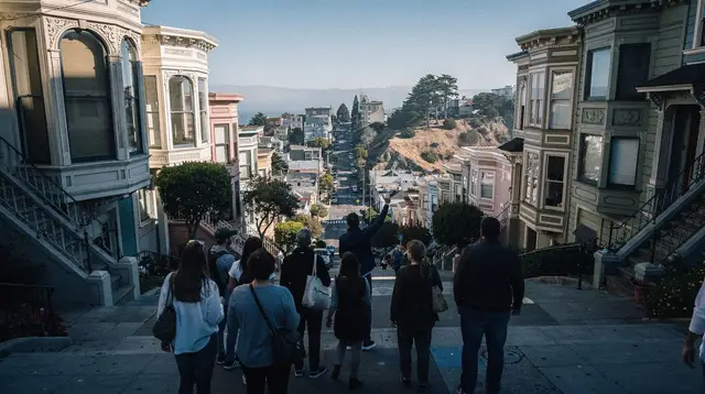
Unlike the largely flat, rectangular Chinatowns found in many other North American cities, San Francisco’s Chinatown climbs a genuine hillside — it sits directly between the Financial District at sea level and the top of Nob Hill, one of San Francisco’s steepest neighborhoods. Grant Avenue and Stockton Street both have a real, sustained grade to them, and several of the connecting streets and alleys are steep enough that stairs supplement the sidewalk in places.
This has two practical effects for visitors. First, comfortable shoes matter more here than the compact scale of the neighborhood suggests — the length of Grant Avenue from the Dragon Gate to Broadway is only about 15-20 minutes at a flat-ground pace, but the climb adds real effort. Second, it’s also part of what makes the neighborhood visually distinct: sightlines up cross streets toward Nob Hill’s apartment towers, and the cable car lines that climb directly through the neighborhood’s edge, give San Francisco’s Chinatown a vertical, layered feel that flatter Chinatowns elsewhere don’t have.
The oldest Chinatown in North America
San Francisco’s Chinatown traces back to the early 1850s, making it the oldest Chinatown in North America and, by most estimates, the largest Chinatown outside Asia. It grew directly out of the California Gold Rush, as Chinese immigrants arriving to mine, and later to build the transcontinental railroad, settled in this stretch of blocks near the waterfront. The neighborhood survived the 1906 earthquake and fire, which destroyed nearly all of it, and was deliberately rebuilt in the ornate, pagoda-influenced style still visible on Grant Avenue today — a style that was, in part, a conscious effort by the community to make the rebuilt neighborhood more distinctly and visibly Chinese, and harder for the city to seize the land for other development.
That history is worth knowing before comparing this Chinatown to others. A Chinatown built in the 1960s-80s in a newer North American city, on a flat modern grid with wide streets, is a fundamentally different kind of place from a neighborhood that has been continuously inhabited on the same hillside blocks for over 170 years, survived a citywide disaster, and rebuilt itself twice over. The narrowness of the alleys, the density of the buildings, and the layering of temples above shopfronts are all products of that specific, much longer timeline.
How San Francisco’s Chinatown compares to others visitors may know
| Feature | San Francisco Chinatown | Typical newer-city Chinatown |
|---|---|---|
| Founded | Early 1850s | Often mid-to-late 20th century |
| Terrain | Steep hillside | Usually flat |
| Entrance | Ceremonial Dragon Gate (1970) | Varies; often no formal gate |
| Layout | Historic grid + hidden alley network | Modern grid, fewer historic alleys |
| Scale | Largest Chinatown outside Asia | Generally smaller |
| Core streets | Grant Ave (visitor-facing) / Stockton St (local) split | Often a single main commercial strip |
The two-street split — one corridor built for visitors, a parallel one built for residents — is less pronounced in many newer Chinatowns, which tend to be smaller and more single-purpose. San Francisco’s version is old and large enough to have developed distinct visitor and resident economies that run side by side rather than overlapping.
A practical route through the neighborhood
A straightforward, well-paced route: start at the Dragon Gate on Grant Avenue at Bush Street for the photo and orientation, walk north on Grant Avenue taking in the shopfronts and facades, detour into Waverly Place for the painted balconies and Tin How Temple, continue to Ross Alley for the fortune cookie factory, then cross west to Stockton Street and walk south through the produce and market blocks back toward Union Square. Built this way, the loop covers both faces of the neighborhood rather than just its front window, and takes roughly 1.5-2.5 hours at an unhurried pace with stops.
For visitors who’d rather have the layout, history and etiquette explained as they go rather than piecing it together from a map, a guided option covers the same ground with context built in. On a guided walk through Chinatown’s main streets and back alleys, a local guide typically routes between Grant Avenue and Stockton Street, points out the temples tucked above street level on Waverly Place, and explains details — like why the buildings look the way they do after 1906 — that are easy to miss on a self-guided pass.
Food as a way into the neighborhood
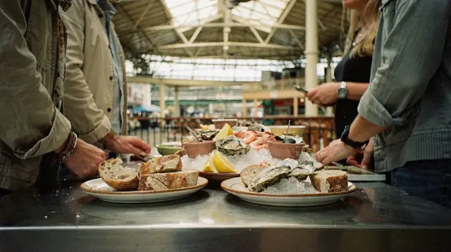
Chinatown’s food culture runs on the same two-street split as everything else: Grant Avenue has sit-down restaurants aimed at visitors, while Stockton Street’s bakeries, dim sum counters and market stalls are where the neighborhood actually eats day to day. A dedicated food-focused walk is one of the more efficient ways to taste across that divide in a single outing rather than guessing which door to pick. Travelers combining a Chinatown visit with a wider look at the Bay Area’s food scene sometimes also add a guided food tour through Berkeley’s restaurant and market scene on a separate day, since the East Bay’s food culture — shaped by a different immigrant history and a very different, flatter layout — makes an interesting contrast to Chinatown’s dense hillside blocks.
Getting there and getting around
Chinatown sits close enough to Union Square and the Financial District that most visitors simply walk in, but a couple of transit options are worth knowing. The Powell-Mason and Powell-Hyde cable car lines climb along the edge of Chinatown and Nob Hill on their way from Union Square toward Fisherman’s Wharf, and the California Street line crosses the neighborhood’s northern edge directly at Grant Avenue and Stockton Street. Riding a cable car isn’t the fastest way to cover Chinatown itself — walking the compact core is easier — but it’s a scenic way to approach or leave the neighborhood, and pairing a cable car ride with a walk is a common combination. A self-guided cable car audio tour app can add context to that ride if you’re not booking a separate walking guide for Chinatown itself.
For visitors staying elsewhere in the city, Chinatown connects easily on foot from Union Square, North Beach and the Financial District, and by Muni bus from most other neighborhoods; driving in isn’t recommended, since street parking is scarce and expensive on the hillside blocks. For orientation to the wider city beyond Chinatown, the San Francisco neighborhoods guide sets Chinatown in context alongside North Beach, the Mission District and Fisherman’s Wharf.
Etiquette worth knowing before you go
Chinatown is a residential and commercial neighborhood first, a tourist attraction second — people live above the shops, run the market stalls, and use Stockton Street the way any neighborhood uses its high street. A few small habits go a long way: ask before photographing individual vendors or shoppers up close, keep noise down inside temples like Tin How Temple and remove hats where signage asks, and expect market-stall prices and interactions on Stockton Street to move at local speed rather than tourist speed. None of this requires special preparation, just the same basic courtesy you’d extend in any dense, lived-in neighborhood. For more detail, the Chinatown etiquette guide covers specific situations visitors commonly ask about.
When to visit
Chinatown is busiest, and arguably most atmospheric, in the late morning through mid-afternoon, when both Grant Avenue’s shops and Stockton Street’s markets are in full swing. Early morning (before about 9am) is quieter and shows Stockton Street’s market deliveries and setup, which some visitors find more interesting than the midday crowds. If your trip lands around Lunar New Year (dates vary by year, typically late January to mid-February), Chinatown hosts San Francisco’s largest annual parade and is dramatically busier and more decorated than at any other time — worth seeking out deliberately if your dates align, and worth planning around if you prefer a quieter visit.
Chinatown pairs naturally with a broader first day in the city. If you’re mapping out how the neighborhood fits into a longer stay, the San Francisco in one day itinerary and the self-guided walking tour of San Francisco both route through Chinatown as one stop among several, useful starting points if this is your first visit to the city rather than a dedicated Chinatown day.
Chinatown at a glance
| Detail | Information |
|---|---|
| Main entrance | Dragon Gate, Grant Avenue at Bush Street |
| Distance from Union Square | 5-10 minute walk |
| Main tourist street | Grant Avenue |
| Main local/market street | Stockton Street |
| Notable alleys | Waverly Place, Ross Alley |
| Founded | Early 1850s |
| Status | Oldest Chinatown in North America; largest outside Asia |
| Walking time (Grant Ave, gate to Broadway) | 15-20 minutes |
| Full visit with alleys and food stop | 1.5-2.5 hours |
| Nearby cable car lines | Powell-Mason, Powell-Hyde, California Street |
Frequently asked questions about San Francisco’s Chinatown
Where does Chinatown officially begin?
At the Dragon Gate (also called the Chinatown Gate) on Grant Avenue at Bush Street, the neighborhood’s ceremonial southern entrance a few blocks north of Union Square. Chinatown has no fence or wall beyond this, but the gate marks the traditional, photographed starting point most visitors use.
Is Grant Avenue or Stockton Street the “real” Chinatown?
Both are real, but they serve different purposes. Grant Avenue is the historic, souvenir-shop-lined tourist corridor with pagoda-style facades; Stockton Street, one block west, is the working produce-and-herb-market street locals actually use for daily shopping, with far fewer signs in English.
How is San Francisco’s Chinatown different from Chinatowns in other cities?
It’s the oldest Chinatown in North America, dating to the early 1850s, and the largest Chinatown outside Asia. Unlike the flat, grid-based Chinatowns in many other cities, it’s built across a steep hillside between Union Square and Nob Hill, which shapes everything from its narrow alleyways to its views.
How long does it take to walk through Chinatown?
Walking the length of Grant Avenue from the Dragon Gate to Broadway takes about 15-20 minutes at a steady pace. A proper visit that includes a couple of alleys, a temple, and a stop for food realistically takes 1.5-2.5 hours.
Is Chinatown walkable from Union Square?
Yes. The Dragon Gate is roughly a 5-10 minute walk north from Union Square along Grant Avenue or Powell Street, making Chinatown one of the easiest add-ons to a Union Square or Financial District visit.
What’s the best way to see Chinatown without getting lost in the touristy parts?
Enter at the Dragon Gate for the photo, then deliberately duck off Grant Avenue into Waverly Place or Ross Alley, and cross over to Stockton Street for a few blocks before looping back. A guided walking tour is also an efficient way to get the history and the alley access in one pass.
Do the cable cars go through Chinatown?
Yes. The Powell-Mason and Powell-Hyde cable car lines both climb through the edge of Chinatown and Nob Hill, and the California Street line crosses Chinatown’s northern edge at Grant Avenue and Stockton Street — useful for a quick, scenic approach, though walking is easier for exploring the alleys themselves.
San Francisco by Neighborhood
Verified deep-linked GetYourGuide tours. Book through these links and we earn a small commission at no cost to you.
GetYourGuide does not provide a product photo for this activity — the image shows the meeting point, photographed by us.