Big Sur Hiking Trails: State Park Walks and Coastal Viewpoints
Can you hike in Big Sur without a backcountry permit or a multi-day trip?
Yes. Julia Pfeiffer Burns State Park, Pfeiffer Big Sur State Park and Point Lobos (just north, near Carmel) all have short, well-marked trails from paved parking lots, most under 2 miles round trip. A day pack, water and a state park day-use fee are all that's required.
Big Sur has a reputation for wild, remote hiking — multi-day backpacking into the Ventana Wilderness, permits, and long approaches. That reputation is accurate for the backcountry, but it obscures a simpler truth: some of the most dramatic scenery on this stretch of coast is reachable on foot from a paved parking lot in under an hour, no permit and no serious elevation required. This guide covers those trails — the ones that fit into a Highway 1 road trip or a day trip from Monterey or Carmel-by-the-Sea without committing to a backcountry itinerary.
Where these trails sit on Highway 1
Big Sur is not a town with a single trailhead; it’s roughly 90 miles of coastline south of Carmel-by-the-Sea, strung along a single winding highway with a scattering of state parks, pullouts and a handful of small settlements. The trails below cluster around two state parks close to each other on Highway 1, plus one bonus stop just north near Carmel-by-the-Sea: The Quiet Village South of Monterey, making it realistic to see three or four of them in a single day without excessive backtracking.
Driving time matters more than mileage here. Highway 1 through Big Sur is narrow, cliff-hugging and slow — 25-35 mph is normal, slower behind RVs or during roadwork. Budget more time than a map app suggests, and check Highway 1 Driving Tips for Big Sur: What I Wish I’d Known before setting out, especially outside summer when temporary closures happen after storms.
McWay Falls Overlook Trail — Julia Pfeiffer Burns State Park
This is the single most photographed short walk on the entire California coast, and for good reason: an 80-foot waterfall drops directly onto a sand cove, framed by cliffs, visible from a fenced overlook reached by a flat, paved path under half a mile round trip from the parking lot. There is no beach access — the cove is closed to visitors — so the entire experience happens from the overlook itself, through a short tunnel under Highway 1.
Because it requires almost no physical effort, this trail draws the heaviest crowds of any stop on this list. Arriving early morning or in the last hour before sunset avoids the worst of the parking lot overflow, which can back up onto the highway shoulder on busy weekends. The day-use fee is paid at the park’s self-serve station.
Canyon Trail and the redwood groves — Julia Pfeiffer Burns State Park
From the same parking area, a longer and steeper option climbs inland along Canyon Trail through second-growth redwood forest, following Falls Creek before the trail was affected by past storm damage — check current state park postings for which segments are open, since redwood-canyon trails on this stretch of coast are among the most weather-affected in the park system. When open, it’s a genuinely different experience from the coastal overlook: shaded, quiet, and cooler, often 10-15 degrees cooler than the exposed highway pullouts.
Because storm damage closures on Canyon Trail can change from one season to the next, it’s worth treating it as a bonus rather than the centerpiece of a plan — build the day around McWay Falls and Pfeiffer Big Sur’s trails, and treat a fully open Canyon Trail as a welcome extra rather than something to count on before arriving.
Valley View Trail — Pfeiffer Big Sur State Park
A few miles north, Pfeiffer Big Sur State Park is inland rather than directly on the coast, set among old-growth redwoods along the Big Sur River. The Valley View Trail is a moderate loop of roughly 2 miles with a real but manageable climb, rewarded with an open viewpoint looking back down the Big Sur River valley toward the ocean — one of the few hikes on this list that gains enough elevation to give a wide view rather than a single framed overlook.
This park also has flatter riverside paths suitable for a shorter, easier walk, and picnic areas that make it a natural lunch stop between coastal viewpoints. It’s a separate park from Pfeiffer Beach, a common point of confusion — Pfeiffer Beach is a distinct, unsigned coastal access point with its own narrow access road, not part of this state park.
Buzzards Roost Trail — Pfeiffer Big Sur State Park
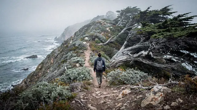
A longer loop from the same park, Buzzards Roost climbs to a ridge with panoramic views back over the redwood canyon and, on clear days, glimpses of the ocean. At around 4-5 miles round trip with meaningful elevation gain, this is the most demanding trail in this guide — still a day hike with no permit required, but it deserves an early start, real hiking shoes, and enough water, rather than the casual approach that works for the McWay Falls overlook.
Point Lobos — just north, near Carmel-by-the-Sea
Technically outside Big Sur proper, Point Lobos State Natural Reserve sits right where the coastal drive begins south of Carmel-by-the-Sea: The Quiet Village South of Monterey, and it’s worth pairing with a Big Sur day because its trails are shorter, flatter and arguably even more scenic at water level — cypress groves, tide pools, and reliable sightings of sea lions and, seasonally, migrating whales from the bluffs (see Monterey Whale Watching: Operators, Seasons and What You’ll See for timing). Several loop options run 1-3 miles on well-maintained coastal paths, making it a good warm-up or wind-down for a day built around the Julia Pfeiffer Burns and Pfeiffer Big Sur trails further south.
For travelers building a wider loop, Point Lobos also works as the hinge between a Big Sur hiking day and the rest of the Monterey Peninsula — the Monterey vs Carmel comparison guide lays out how the two towns differ for a base, and the Carmel-by-the-Sea photoshoot guide covers the coastal light that makes this stretch popular with photographers as well as hikers.
Quick comparison
| Trail | Location | Round trip | Difficulty | Highlight |
|---|---|---|---|---|
| McWay Falls Overlook | Julia Pfeiffer Burns SP | Under 0.5 mi | Easy, paved | Waterfall onto sand cove |
| Canyon Trail (where open) | Julia Pfeiffer Burns SP | Varies | Moderate | Redwood canyon |
| Valley View Trail | Pfeiffer Big Sur SP | ~2 mi | Moderate | River valley overlook |
| Buzzards Roost Trail | Pfeiffer Big Sur SP | ~4-5 mi | Harder | Ridge panorama |
| Point Lobos loops | Near Carmel-by-the-Sea | 1-3 mi | Easy-moderate | Coastal cypress, wildlife |
Planning a day around these trails
From San Francisco, this is not a comfortable round-trip day. The drive alone to Julia Pfeiffer Burns State Park runs 2.5-3 hours each way on a road that rewards slow, unhurried driving rather than a rushed there-and-back. See Big Sur Day Trip from San Francisco: What’s Realistic and Is Alcatraz Worth It? What the Ticket Price and Booking Hassle Actually Buy You-style reality checks apply here too: a one-way drive-through, spending a night in Big Sur or Cambria, turns a exhausting slog into an actual visit with time to walk more than one trail properly. Highway 1 Coastal Road Trip: San Francisco to Big Sur and 5 Days: San Francisco and the Central Coast both build this in as an overnight rather than a day trip.
From Monterey or Carmel-by-the-Sea, the calculus is different — Julia Pfeiffer Burns is under an hour away, making a half-day or full-day loop through two or three trailheads realistic without an overnight. This is the more common way visitors actually experience these trails; see Carmel-by-the-Sea Day Trip Guide from San Francisco and Monterey for the wider context.
Weather and fog behave differently here than in San Francisco itself. Coastal fog can sit over the Big Sur shoreline while inland trails like Valley View stay clear, and the reverse happens too. A layered jacket earns its keep on every one of these trails, regardless of season — the exposed overlooks are windier and cooler than the parking lots suggest.
Driving Highway 1 yourself vs. a guided tour: the road’s tight curves and lack of guardrails in places make some visitors happier letting someone else drive. A guided half-day tour from Monterey covers several of these viewpoints without the responsibility of driving, and a full-day Highway 1 tour departing San Francisco handles the whole round trip from the city in one organized outing rather than a self-driven overnight.
For a different pace entirely, a vintage Porsche 356 Speedster rental turns the drive itself into the main event. Those coming from the South Bay can also start with a 17-Mile Drive, Big Sur and Carmel tour from Cupertino that bundles the coastal highlights with Pebble Beach’s famous drive.
What to bring and what to skip
None of the trails above require technical gear, but coastal conditions punish under-preparation more than the mileage suggests:
- Water and snacks — no services exist at most trailheads beyond a restroom and a fee station.
- Layers — fog, wind and direct sun can each show up within the same afternoon.
- Sturdy shoes — even the paved McWay Falls path has uneven edges; Buzzards Roost and Canyon Trail need real hiking shoes.
- Cash or a card for the day-use fee — self-serve stations at both state parks, typically around $10 per vehicle.
- No reliable cell signal — download maps or directions before arriving; see Highway 1 Driving Tips for Big Sur: What I Wish I’d Known for more on driving this stretch prepared.
- Skip the backcountry gear — none of these routes need a wilderness permit, a bear canister or an overnight pack; that’s a different, longer trip into the Ventana Wilderness interior, not covered here.
For a wider look at how these short hikes fit into a longer Central Coast trip, see Big Sur vs Santa Cruz: Which Coastal Day Trip Should You Pick? and Six-Day Northern California Loop: Wine Country to Big Sur, both of which treat Big Sur as a stop worth a night rather than a rushed afternoon.
Other hikes within reach of San Francisco
Big Sur is the most dramatic short-trail destination on this coast, but it’s not the only place near San Francisco to get a proper walk in without a backcountry commitment. Closer to the city, Muir Woods’ hiking trails cover old-growth redwoods on a much shorter drive across the Golden Gate Bridge, and the Lands End coastal trail offers sea-cliff views inside San Francisco itself, no car required. Inside Golden Gate Park, the Golden Gate Park walking tour guide covers flatter, easier ground for a half-day stroll.
At the opposite end of the spectrum, the Yosemite hiking trails guide describes a genuinely different kind of hiking — granite domes and alpine terrain reached by a 3.5-4.5 hour drive, not a coastal day trip. For travelers weighing several nature-focused stops around the Bay Area in one visit, the hiking and nature escape from San Francisco itinerary strings together a few of these options rather than trying to fit them all into a single overloaded day.
Where to base yourself for more than one day
Anyone spending a full day or two on these trails benefits from thinking about logistics before Highway 1’s curves start eating the schedule. The Big Sur Highway 1 road trip and car rental guide covers what kind of vehicle and rental setup suits this road, since the tight turns and limited passing room reward a smaller car over a large SUV. For a base with more restaurants and lodging options than Big Sur itself offers, the towns of Carmel-by-the-Sea and Monterey sit close enough to Point Lobos and Julia Pfeiffer Burns State Park to make a comfortable multi-day hub, and Big Sur itself has a handful of lodges for those who’d rather wake up already on the coast.
Travelers approaching from the north along Highway 1 sometimes combine these trails with a stop in Santa Cruz; the peninsula coast and Santa Cruz day trip itinerary and the 17-Mile Drive: is it worth it? piece both help decide what else to fold into the same stretch of coast. For a structured multi-day version of this whole route, the Monterey and Carmel coastal escape itinerary builds a full loop around exactly these trailheads.
Big Sur hiking trails: frequently asked questions
Do I need a permit to hike in Big Sur’s state parks?
No backcountry permit is needed for the day-use trails covered here. Each state park charges a day-use vehicle fee, typically in the $10 range, paid at a self-serve station or kiosk at the entrance.
What is the easiest walk to McWay Falls?
The McWay Falls Overlook Trail in Julia Pfeiffer Burns State Park is under half a mile round trip on a flat, paved path from the parking lot, ending at a fenced overlook above the waterfall and cove.
How far is Big Sur from San Francisco, and can it be a day trip?
The most-photographed points, Bixby Bridge and McWay Falls, start around 2.5-3 hours’ drive from San Francisco one-way. A there-and-back day trip is a very long day of driving on a slow, winding road; a one-way drive-through with a night in Big Sur or Cambria works far better than a round trip.
Is Pfeiffer Big Sur State Park the same as Pfeiffer Beach?
No. Pfeiffer Big Sur State Park is inland, along Highway 1, with redwood groves and the Valley View Trail. Pfeiffer Beach is a separate, unsigned coastal access point reached by a different, easy-to-miss turnoff — check current access status before visiting either.
Are the Big Sur trails suitable for kids or casual walkers?
Many are. The McWay Falls Overlook, the Buzzards Roost loop’s lower sections, and the short Point Lobos coastal paths near Carmel are gentle and paved or well-graded. Trails climbing into the redwood canyons involve more elevation gain and uneven footing.
Can I combine a Big Sur hike with a Highway 1 road trip from San Francisco?
Yes — most visitors pair a stop at one or two trailheads with a scenic drive through Carmel-by-the-Sea and Monterey. A guided tour is a practical option for those who would rather not drive Highway 1’s curves themselves.
What should I bring for a short Big Sur hike?
Water, sun protection, sturdy shoes and a layered jacket — coastal fog and wind can make the same afternoon feel very different at the overlook than in the parking lot. Cell signal is unreliable throughout the area.
Is fall a good time to hike in Big Sur?
Fall (September-October) often brings clearer, warmer weather than midsummer’s coastal fog, though conditions vary year to year. Trails and roads can also close temporarily after winter storms or wildfires, so checking current state park alerts before a visit is worthwhile.
Hiking in Muir Woods and Beyond
Verified deep-linked GetYourGuide tours. Book through these links and we earn a small commission at no cost to you.
GetYourGuide does not provide a product photo for this activity — the image shows the meeting point, photographed by us.