Big Sur Day Trip from San Francisco: What's Realistic
Is Big Sur doable as a day trip from San Francisco?
Yes, but only the northern stretch. The most-photographed points — Bixby Bridge and McWay Falls — sit roughly 2.5-3 hours from San Francisco each way, so a round trip already means 5-6 hours of driving before you factor in stops, fog, or weekend traffic on Highway 1.
Why “Big Sur in a day” needs a reality check
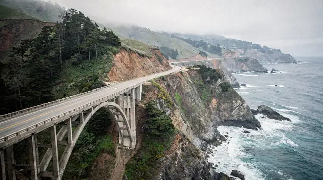
Big Sur shows up on almost every San Francisco bucket list, usually next to a photo of Bixby Bridge arcing over a blue cove. What that photo doesn’t show is the drive: Big Sur isn’t a single stop, it’s a roughly 90-mile stretch of Highway 1 between Carmel and San Simeon, and the parts everyone means when they say “Big Sur” — Bixby Bridge, Point Sur, McWay Falls — sit about 2.5 to 3 hours south of San Francisco each way. That’s before you’ve stopped for a single photo.
This guide is built around one question: how far can you realistically go and come back the same day, and where should you draw the line and either turn around or plan a night away. If you’re weighing Big Sur against other coastal options, the Big Sur versus Santa Cruz comparison is worth a look before you commit a full day to the drive. If you’d rather not choose between Big Sur and its northern neighbors at all, the Monterey and Carmel coastal escape itinerary spreads the same coastline over more than one day, which removes most of the time pressure this guide is built around.
The honest driving-time math
There are two routes south from San Francisco, and they matter for how your day actually unfolds.
Highway 1 the whole way hugs the coast through Half Moon Bay, Santa Cruz, and Monterey before reaching Big Sur. It’s the scenic choice and the slower one — narrow, winding in places, and genuinely time-consuming if you stop often.
Highway 101 to Monterey, then Highway 1 south is faster for the first two-thirds of the trip, cutting inland through San Jose and Gilroy before rejoining the coast near Monterey. Most day-trippers use this route to bank time, saving the slow, scenic driving for the Big Sur stretch itself where it actually earns the extra minutes.
| Destination | Approx. drive time from San Francisco (one-way) | Realistic as a day trip? |
|---|---|---|
| Half Moon Bay | 45 min - 1 hour | Yes, easily, on its own |
| Santa Cruz | About 1.5 hours | Yes |
| Monterey / Cannery Row | About 2 hours | Yes |
| Carmel-by-the-Sea | About 2 hours | Yes |
| Bixby Bridge | About 2.5 hours | Yes, as the main goal |
| McWay Falls | About 2.5-3 hours | Yes, if Bixby Bridge is also on the list |
| Limekiln State Park / far south Big Sur | About 3.5-4 hours | Not really — overnight recommended |
| Esalen area and beyond | 4+ hours | No — this is overnight-trip territory |
Add real-world time on top of any of these figures: Highway 1 has no passing lanes for long sections, so a slow RV or a line of cyclists can add 15-20 minutes without warning. Fog can also slow things down, particularly in the morning near the coast.
When to go: season and time of day
Timing matters almost as much as route choice on this drive. Coastal fog is a fact of life along Highway 1, and it tends to be thickest in the morning and during the summer months, when it can sit over Monterey, Carmel, and the Big Sur coastline well past sunrise before burning off. That’s part of why an early departure from San Francisco pays off twice: it beats traffic on the 101/1 corridor and buys time for the fog to clear before you reach the coast. The guide to summer fog in San Francisco covers the pattern in more detail if you’re trying to time a trip around clearer skies.
Outside of fog, the difference between seasons is mostly about crowds and daylight. Shorter winter days mean less buffer if you get a late start or hit a closure, while spring and fall tend to offer a middle ground of decent visibility and lighter weekend traffic around Monterey and Carmel. The best time to visit San Francisco guide has more on how the city’s own seasonal patterns line up with day trips like this one. Whatever the season, a weekday departure is worth considering over a weekend if your schedule allows it — Highway 1’s narrow, two-lane sections feel the congestion around Carmel and Monterey most on Saturdays and Sundays.
What a realistic one-day itinerary actually looks like
The version of “Big Sur in a day” that works is really a Monterey-Carmel-Big Sur loop, not a straight shot to Big Sur and back. Because Monterey and Carmel-by-the-Sea sit right at the northern edge of the Big Sur coastline, most successful day trips treat them as the first two stops, then push further south for an hour or two before turning back.
A workable rough schedule:
- Leave San Francisco by 7:00-7:30am. Early starts matter twice over here — less traffic on the 101/1 corridor near San Jose, and a better shot at beating the coastal fog that tends to burn off by mid-morning.
- Monterey or Cannery Row, late morning. A coffee stop, a walk along the water, maybe a quick look at Cannery Row before continuing.
- 17-Mile Drive and Carmel-by-the-Sea, mid-morning to early afternoon. The 17-Mile Drive through Pebble Beach is a scenic detour many visitors debate — it has a toll gate and a slower pace, so budget an extra 45-60 minutes if you take it.
- Bixby Bridge, early-to-mid afternoon. The single most photographed stop on this route and, for many day-trippers, the actual turnaround point.
- McWay Falls, if time allows. About 20-25 minutes south of Bixby Bridge, this is usually the furthest point worth pushing to on a same-day return.
- Turn around by mid-afternoon. Aim to start heading back no later than 3:00-4:00pm — the return drive takes just as long as the way down, and Highway 1 is not a road you want to be on after dark if you can avoid it, especially in fog.
That schedule already adds up to a long day: roughly 6-7 hours of driving alone, plus stops. It’s doable, but it’s not a relaxed outing — it’s a full commitment of the day.
Where to actually draw the line
The temptation on Highway 1 is to keep going “just a little further” once you’re already in Big Sur, because each viewpoint promises another one just past it. Here’s where that instinct stops paying off:
- Bixby Bridge and Point Sur — worth the drive, no question, and achievable on a day trip with room to spare for the return.
- McWay Falls / Julia Pfeiffer Burns State Park — still realistic, but this is where the “should I keep going” math starts to matter. If you’ve had a late start or lingered in Carmel, this may need to be the actual endpoint.
- Limekiln State Park and points further south — technically reachable, but by the time you arrive and turn around, you’re looking at a 10-12 hour day including drive time, with very little time actually spent anywhere. This is the point where an overnight in Big Sur or continuing on to Cambria makes far more sense than a round trip.
- Esalen, Salmon Creek, and the wilder southern stretches — not a day trip from San Francisco under any reasonable schedule. These belong to a multi-day coastal itinerary, not a single push down and back.
If the far south of Big Sur is genuinely the goal, look at the Highway 1 coastal road trip itinerary or the five-day San Francisco and Central Coast itinerary instead — both are built around an overnight stay, which is what unlocks the parts of Big Sur a single day simply can’t reach.
Highway 1 itself: what to expect
Highway 1 through Big Sur is a genuinely two-lane road for most of its length, cut into cliffs with the ocean often directly below and minimal guardrail in places. A few things worth knowing before you go:
- No passing lanes for long stretches. Getting stuck behind a slow-moving vehicle is common and not really avoidable — build in buffer time rather than counting on a steady pace.
- Closures happen. Landslides, storm damage, and repaving projects close sections of Highway 1 with some regularity, sometimes for months. Check current conditions before you leave rather than assuming the road is fully open.
- Cell service is unreliable for long stretches through Big Sur, so download offline maps or directions before you set out.
- Fuel and food options are sparse. There are only a handful of places to eat or fill up once you’re south of Carmel, and they’re small — don’t assume you can just find something around the next bend.
- Pullouts are the point. Resist the urge to keep the car moving toward the “main” stops — some of the best views are unmarked pullouts along the way, and part of what makes the drive worthwhile is stopping for them.
For a deeper dive on the driving conditions specifically, see Highway 1 driving tips for Big Sur.
Driving yourself versus a guided tour
Taking the wheel yourself gives the most flexibility — you can adjust the schedule, linger at a viewpoint that turns out to be better than expected, or cut a stop short if you’re running behind. The trade-off is that whoever’s driving spends the day watching a narrow, winding road instead of the ocean.
A guided option removes that trade-off. A half-day guided trip such as the Monterey-based Big Sur half-day tour covers the core Bixby Bridge and coastal-viewpoint stretch without anyone in the group needing to drive the cliffside sections themselves. For a fuller day that starts from San Francisco and strings together Monterey, Carmel, and Big Sur in one outing, a guided option like the Highway 1 Monterey, Carmel and Big Sur day tour follows roughly the same route described above, run by a driver who already knows where the good pullouts are.
If Pebble Beach’s 17-Mile Drive is part of the plan, a combined outing like the 17-Mile Drive, Big Sur and Carmel tour bundles that detour in without you needing to manage the toll gate and timing yourself. For a smaller group or a more flexible pace, a private Monterey, Carmel and Big Sur day trip keeps the same route but lets the group set the stops and the pace.
For travelers who’d rather not drive to Monterey themselves before the tour even starts, a full-day option such as the San Francisco to Big Sur day tour picks up directly in the city and handles the entire round trip, so the only decision left is how much coffee to bring for the ride.
Alternatives worth weighing
If the drive-time math above is giving pause, a few other options cover similar ground with less total commitment:
- Stop at Monterey and Carmel, skip Big Sur entirely. Both are excellent destinations on their own, about 2 hours from San Francisco (Carmel is already about 2 hours 15 minutes out, and Big Sur itself starts roughly 3 hours out, with slow, winding driving beyond that — it really needs a full day, ideally with a night there), with far less driving risk than pushing into Big Sur. See the Monterey versus Carmel comparison for how the two compare.
- Santa Cruz instead of Big Sur. Roughly an hour closer to San Francisco, with its own boardwalk and coastline, and a much shorter, easier drive. The Big Sur versus Santa Cruz comparison lays out the trade-offs directly.
- Stay overnight in Big Sur or Cambria. This is the real unlock for anyone who wants to see the wilder southern stretches, hike in Big Sur’s trails, or simply not spend 6-7 hours in the car in a single day.
- Rent a car specifically for the coastal stretch. Highway 1 rewards having your own vehicle and your own schedule; the Big Sur Highway 1 road trip and car rental guide covers what to know before booking one.
Practical notes for the day
- Start early. A 7:00-7:30am departure from San Francisco is the single biggest lever for how far south you can comfortably go and still get home before dark.
- Fill the tank before Carmel. Gas stations thin out fast south of there, and prices climb the further south you go.
- Pack food and water. Restaurant options through Big Sur are limited and can have long waits, especially at lunch on weekends.
- Check Caltrans road status the morning you leave. Highway 1 closures aren’t rare, and a closure discovered mid-drive can cost hours of backtracking.
- Decide your turnaround point before you leave, not once you’re there. It’s far easier to stick to “we turn back at McWay Falls” as a plan made at home than to make that call in the moment, standing at the falls, tempted to see what’s just a bit further south.
- Download offline maps before you leave cell coverage. Between spotty reception through Big Sur and the risk of a wrong turn onto a fire road, having directions saved locally rather than relying on a live signal is worth the two minutes it takes.
- Bring layers. Coastal fog and the temperature swing between the water and inland stretches of Highway 1 can make the same day feel like two different climates, even before you factor in how much cooler it is right at the coast than back in San Francisco.
Big Sur as a full day trip from San Francisco works well for the northern half of the coastline — Bixby Bridge, Point Sur, and McWay Falls are all within reach of a long but manageable day. The wilder, quieter stretches further south are real, and worth seeing, but they belong to a trip with a night in Big Sur, not a round trip squeezed into a single day.
Day Trips from San Francisco
Verified deep-linked GetYourGuide tours. Book through these links and we earn a small commission at no cost to you.
GetYourGuide does not provide a product photo for this activity — the image shows the meeting point, photographed by us.